 |
|
 |
|
|
|
|
Concerning Hobbits | Calendars & Chronologies | Shire Library | Shire Geography>Shire Guidebook> The Shire | Mathom House (Misc) | Home
The settling of the Shire was the culmination of the hobbits' slow migration from their homes in the Vales of the Anduin on the east side of the Misty Mountains. The hobbit homeland seems to have been north of the Gladden River on the eastern edge of the Great East Road. The Harfoots first crossed the Misty Mountains around Third Age 1050. They were later joined by the Fallohides and Stoors. At one time, there were hobbit communities from the River Mitheithel to Bree but these communities were eventually abandoned. The earliest and most important hobbit settlement was at Bree and its associated villages, especially in Staddle.
Hobbits from Bree settled Suza or the Shire in Third Age 1600. They were granted lands from the Brandywine Bridge to the Far Downs, an area roughly 40 leagues (120 miles) by 50 leagues (150 miles). The king at Fornost charged the hobbits with maintaining the Bridge of Stonebows, which allowed travellers to cross the Brandywine River and continue on the Great East Road. The Bridge is better known to hobbits as the Brandywine Bridge. The Shire was originally divided into four farthings or sections. Buckland, a thickly inhabited strip of land on the eastern shore of the Brandywine River, was settled in TA 2340 by Gorhendad Oldbuck. The Marish is the land just west of the Brandywine. The Westmarch, to the west of the original Shire, was granted to the hobbits in FO 32 by King Elessar (Aragorn).
Note: Hobbits are more interested in genealogy than geography. Some Shire maps are more carefully drawn than others so there may be some variation in locations.
The Eastfarthing has the oldest communities in the Shire. It is a land of woods, marshes, and croplands. The Marish is a region in the Eastfarthing that borders the Brandywine.
Brockenborings - This village is in the northern part of the Eastfarthing to the west of Scary. Fredegar Bolger later made Brockenborings the headquarters for his band of rebels.
Deephallow - This community grew up near where the Shirebourn flows into the Brandywine. It is near the Overbourn Marshes in the southeastern corner of the Eastfarthing.
Dwaling - The little community of Dwaling lies near the border of the Shire in the far north of the Eastfarthing.
Frogmorton - Frogmorton, one of the large communities on the East Road, lies west of Whitfurrows. Visit its excellent inn, The Floating Log.
Girdley Island - Girdley Island is a large island in the Brandywine River. It lies just north of the Bridge of Stonebows in the Eastfarthing.
Rushey - This small Marish community is north of Deephallow and across from the Buckland community of Standelf.
Scary - Scary sits amidst the Hills of Scary in the northern part of the Eastfarthing. The Quarry is east of Scary.
Stock - The village of Stock is at the northern end of the Marish, just north of where the Stockbrook runs into the Brandywine. The well-known Stock Road runs from the Great East Road west of Bywater through the Green Hills and the Woody End to Stock.
Willowbottom - This riverside community is located in the southern end of the Eastfarthing, near the Thistle Brook and the River Shirebourne.
Whitfurrows - This is the first large community west-bound travellers pass on the East Road.
Woodhall - Woodhall is a pretty community on the border of the forest called Woody End.
The Southfarthing is known for its crops, especially pipe-weed. Longbottom Leaf, Old Toby, and Southern Star are some of the famous strains from the Southfarthing. Southlinch is a rival strain from Bree.
Hardbottle - Hardbottle is the home of the Bracegirdles. Some maps place it in the south-western part of the Southfarthing. Others put it in Northfarthing or Westfarthing.
Longbottom - This is one of the most famous hobbit communities. In SR 1070, Tobold Hornblower of Longbottom became the first to grow pipe-weed. The hobbits of Bree claim that pipe-weed was first grown in Bree and that Tobold Hornblower was merely the first hobbit in the Shire to grow pipe-weed. Pipe-weed is still grown in Longbottom today. Longbottom is in the southern part of the Southfarthing on the way to Sarn Ford.
Pincup - This community is nestled in the Green Hill Country at the northern edge of the Southfarthing.
Sackville - Some place this community in the southern part of the Southfarthing.
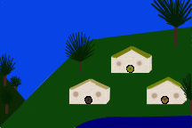
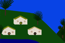
The Westfarthing is home to some of the most famous and important Shire communities. Michel Delving, the capital of the Shire, and the important communities of Bywater, Hobbiton, and Tuckborough are all located here.
Bywater - Bywater is centrally located to many important sites in the Shire and is just north of the East Road. The community of Bywater grew up around the southern edge of the Bywater Pool. When you are there, make sure you visit the Three Farthing Stone, where the East, South, and West Farthings meet. The Three Farthing Stone is only four miles east of Bywater. The town boasts two taverns: The Ivy Bush, a tavern on the Bywater Road, and The Green Dragon, an inn on the Hobbiton side of Bywater.
Gamwich - Gamwich was the home of Hamfast of Gamwich, the founder of the Gamgees. The name for the village comes from the Hobbitish village-name Galabas, which means "game-village." This outlying community is usually shown in the north-western part of Westfarthing, perhaps near Tighfield.
Greenholm - Fastred of Greenholm, who later lived in the Far Downs, came from Greenholm. This distant community may be on the western boundary of the Westfarthing on the Great East Road.
Hobbiton - This most famous of hobbit communities is located a little ways north of the East Road. Bywater is one to four miles away. The Water runs through Hobbiton. Most hobbit holes are found across the bridge on the southern banks of The Water. The Bywater Road can also be found south of The Water. Sandyman's Mill is on the north bank of The Water. It was later replaced by the larger New Mill. The Grange, with its associated granaries, was north of the Mill and was on the west side of the road to The Hill. It was later replaced by tarred sheds. The nicer hobbit holes, such as the hole of Bilbo and Frodo Baggins, are found to the north in Bag End Underhill. Bagshot Row, with humbler hobbit holes, was on its southern flank. Hobbiton is a small village with no inn or public house. To find such establishments, the hobbits of Hobbiton must walk over a mile to The Ivy Bush and The Green Dragon in Bywater.
Little Delving - This pleasant little community is located in the north-western part of the Westfarthing.
Michel Delving - Michel Delving is the chief township and capital of the Shire. It lies in the western part of the Westfarthing on the White Downs. It has the hobbit hole of the Mayor, the Lockholes, and the Mathom-house. The Mayor presides over banquets. As First Shirriff, the Mayor is in charge of the Watch. As Postmaster, he is in charge of the Messenger Service. The Lockholes is the little-used prison, which often is used more as a storage room. The Mathom-house is a museum with arms and other mathoms. Bilbo Baggins' mithril-mail was in the Mathom-house for a time.
Needlehole - A riverside community along the banks of The Water on the northern edge of the Westfarthing.
Nobottle - Another community in the northern part of the West Farthing. This community lies west of Needlehole.
Overhill - This community lies on the north side of Hobbiton Hill (the Hill) from Hobbiton.
Tighfield - This working-class community is associated with Gamwich. It may be in the north-western part of the West Farthing.
Tookbank - This is a Took community east of Tuckborough in the Western Green Hills.
Tuckborough/Tuckburrow - Tuckborough is the famous home of the Tooks. The community lies in the south-eastern edge of the Westfarthing. Isengrim II began work on the Great Smials of Tuckborough in TA 2683. The Great Smials has one of the biggest libraries in the Shire.
Waymeet/Waymoot - Waymeet is a large community on the East Road. It is 15 miles west of Bywater and about 30 miles east of Michel Delving. Waymeet lies at the intersection of the Great East Road and the road from Sarn Ford.
Whitwell - Whitwell is a small community west of Tookbank. Pippin's father has a farm in Whitwell near Tuckborough.
The Northfarthing is known for its barley fields and hunting grounds. The soil tends to be quite rocky. The climate is cooler and drier than elsewhere in the Shire. It is the only place where snow is common.
Greenfields - The community of Greenfields is best known as the location of the Battle of Greenfields (TA 2747). It is probably in the far north of the Northfarthing.
Long Cleeve - Long Cleeve is the home of the North Tooks. It may be in the north-western part of the Northfarthing.
Oatbarton - This is a small community in the Northfarthing.
Sources:
The Atlas of Middle-Earth, Karen Wynn Fonstad, New York: Houghton Mifflin Company, 1991.
The Complete Guide to Middle-Earth: From the Hobbit Through the Lord of the Rings and Beyond (Tolkien's World From A to Z), Robert Foster, New York: Ballantine Books, 2001, 1971.
Journeys of Frodo: An Atlas of JRR Tolkien's The Lord of the Rings, Barbara Strachey, London: HarperCollins Publishers, 1998, 1981.
And,
The Lord of the Rings by JRR Tolkien.
Visit "Shire Geography"
Visit "Shire Guidebook: Buckland and Natural Features"
Visit our smial (home)
Updated January 3, 2012